Cadastral plan extract, online
The official graphic representation of a property on the orthophoto map, issued by ANCPI, useful for land boundaries and construction projects.
Availability details →Order
This service launches soon at 79 RON. Meanwhile you can order any other document on the site.
See all documents →What is it?
The cadastral plan extract shows the position and boundaries of a property on the orthophoto map (georeferenced aerial photography). It is the graphic complement of the land registry extract.
What you get is a picture rather than a text document: the parcel drawn on top of an aerial photograph, with its cadastral number, its boundaries as they are registered and the neighbouring plots around it. The land registry extract tells you who owns the property and what charges sit on it. The plan tells you where it is and what shape it has. A serious file usually needs both.
It does not set boundaries. It shows them as they were recorded when the property entered the cadastral system, which is not always the same as where the fence stands today. It is not a survey either: measuring the ground, staking the corners and producing the documentation for a division or a boundary correction is work for a licensed surveyor, and no extract replaces it. It is also not proof of ownership.
Architects and designers ask for it at the start of a project, because a permit file needs the property placed in its real surroundings. Buyers of land ask for it before paying a deposit, to see whether the plot in the advert is the plot on the map. It also turns up in boundary arguments between neighbours, in division and merger files, and whenever someone needs to know whether a plot has access to a public road.
The useful part is the comparison between the drawing and the photograph. A building that sits partly outside the registered boundary, a fence running several metres into the neighbour's parcel, a plot that turns out to be landlocked behind someone else's land: these show up at a glance and are expensive to discover after signing. Surface area in a listing is easy to write. Shape and position are harder to arrange.
The common mistake is trusting the sketch the seller sends. A drawing from an old file, a phone photo of a piece of paper or a plan from before a division can all be honest and out of date at the same time. The extract issued by the agency reflects what is currently registered, which is the version that counts on the day someone disputes a boundary.
There are limits worth knowing. A property that was never entered into the cadastral system has nothing to show: the answer there is that no registration exists, not a plan. And the orthophoto is a photograph taken on a particular flight rather than a live view, so a building put up recently may not appear on the image even though the parcel boundaries are current.
The right moment is before the deposit, not before the signature at the notary. If the drawing and the ground disagree, sorting it out takes a surveyor, a corrected documentation and time, and none of that fits between a deposit and a booked signing date.
The extract is issued by the National Agency for Cadastre and Land Registration, through its county offices. The cleanest way to ask for it is with the cadastral number and the locality, both of which appear in the property deed or in any land registry extract. Older properties in some counties carry a topographic number instead. If you have neither, the property can be identified from its full address, which takes one extra search step.
There is a free option, and it deserves an honest description. The agency publishes an online map where anyone can see parcel outlines without paying. It is fine for a first look and for your own curiosity. What it is not is a document: a screenshot carries no institutional signature, and no bank, town hall or court will accept one in a file.
One last confusion to clear up. In Romanian files you will meet the plan de amplasament și delimitare, the placement and boundary plan drawn by a licensed surveyor as part of a cadastral documentation, and the plan de situație attached to a building permit application. Both are produced to order, for a specific purpose. The cadastral plan extract is issued by the agency out of what is already registered, so it answers a different question and does not replace them.
When you need it
- Checking the boundaries of land before purchase
- Construction projects and permits
- Land divisions and boundary work
- Identifying the neighbouring plots
What the document contains
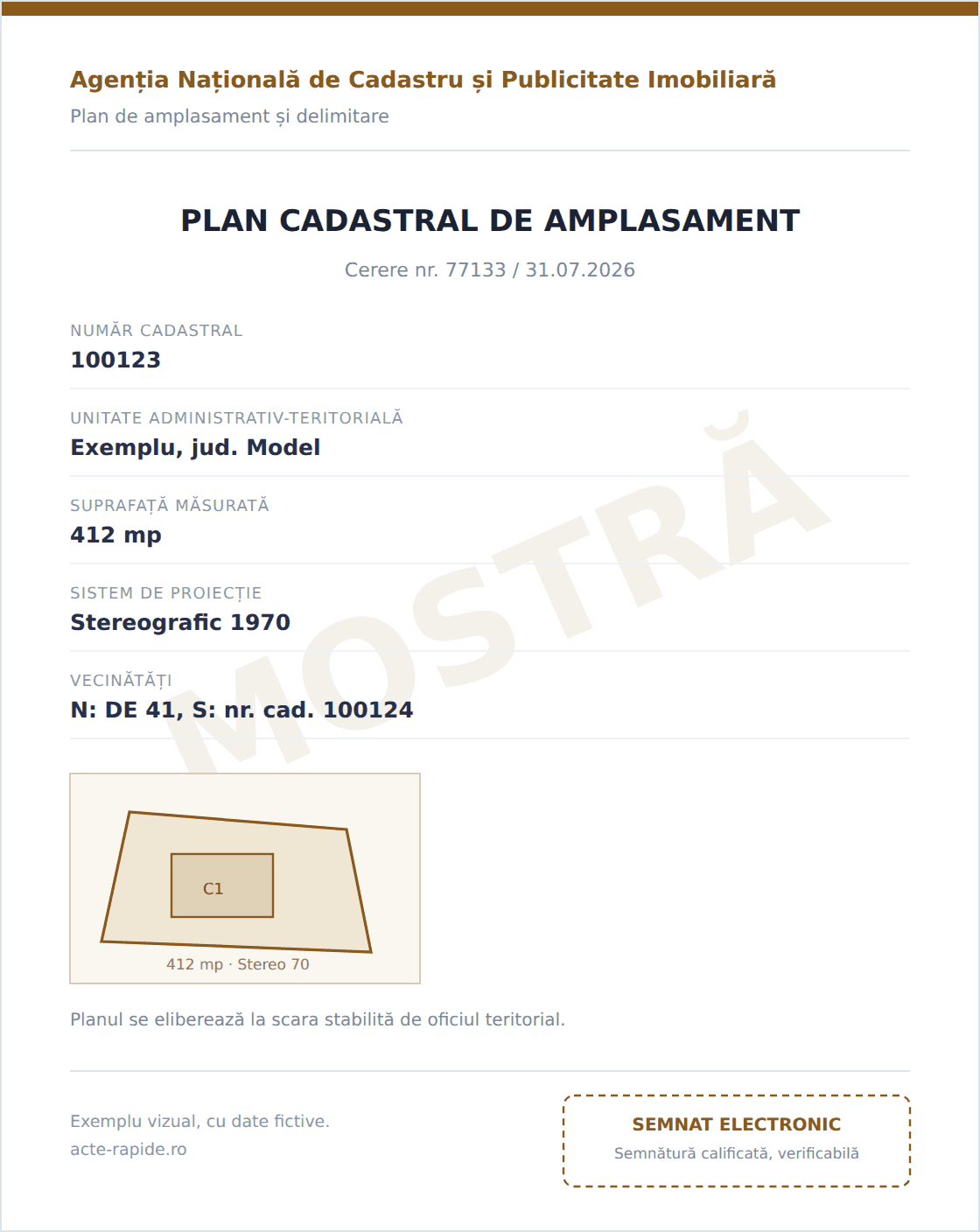
- Graphic representation of the property on the orthophoto
- Boundaries and cadastral number
- The surrounding context
How it works
Three simple steps, from your phone or laptop.
County, locality and cadastral number + your contact details. Under 2 minutes.
Bank card, Apple Pay or Google Pay. The invoice arrives automatically by email.
It arrives by email in usually under 24 hours. We also notify you by SMS.
Frequently asked questions
About this document
How fast is it delivered?
For digitally registered properties usually the same day (maximum 24 working hours); for the rest, up to 2 working days. (Online ordering is temporarily paused; the timeline applies once the service relaunches.)
What information do I need to provide?
The cadastral number and the locality of the property.
This service is launching soon
Online ordering is being reworked. Meanwhile, see the documents available today.
See all documents →